CA25: Riverside North
Designation date: November 2004
No of properties: 62
Area: 27 hectares
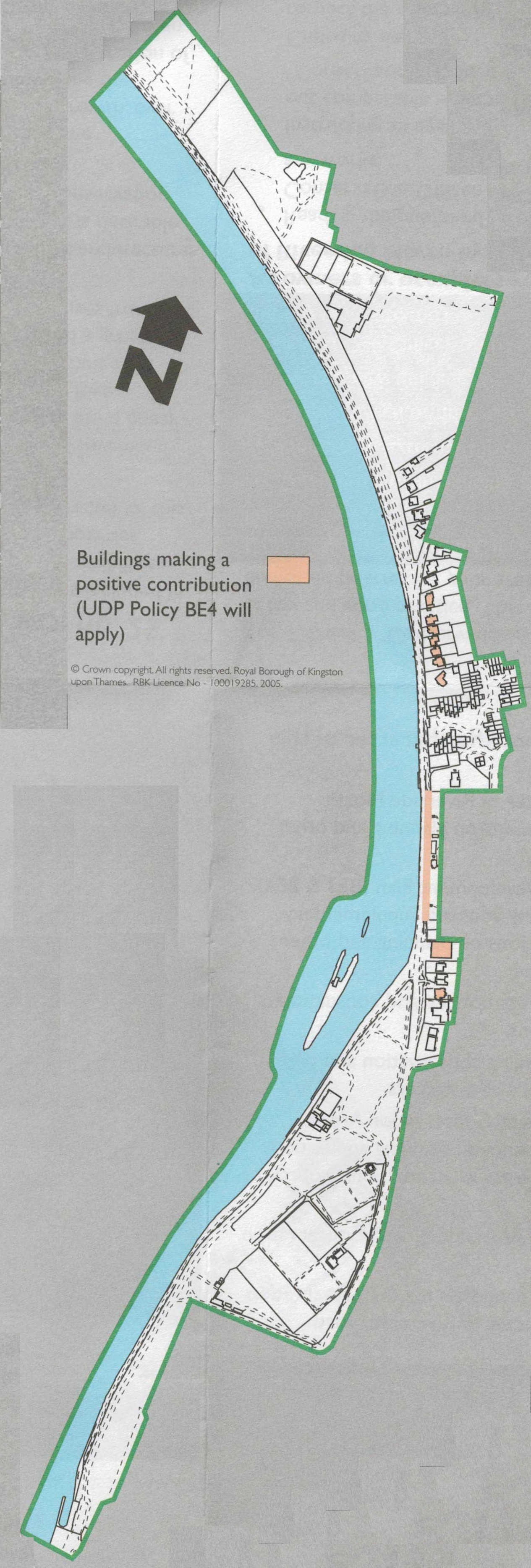
image source: Conservation Area leaflet, 2002.
Heritage Map - shows the updated version, complete with search facility
Designation summary
The special architectural and historic interest of this area can be summarised as:- A linear area whose form and mature landscape is influenced by the River Thames, alongside which lie ancient riverside estates, important 19th century public works that established Canbury Gardens, a group of large Victorian/Edwardian houses and late Victorian boathouses fronting the river.
Historic development
Riverside North was an area of land once ‘held’ by Merton Priory from at least the 14th century. Its latter historic pattern of development is associated with ancient riverside estates and later Victorian benefactors such as the 18th century Bank Grove Estate and the more recent Albany Estate, together with its original boundary garden walls and landscaping. Historically it is made up of the following areas:
Canbury Gardens
John Roques map of 1741-5 shows Canbury Gardens was once an area of woodland. But after the building expansion that followed the arrival of the railway in 1863, the site became a tar factory and rubbish dump. However in 1884 Samuel Gray, whose family had been prosperous maltsters and lightermen in Kingston, proposed to layout a public garden onland known as Cooperation Eyot. Plans were prepared by Borough Surveyor Henry Macaulay and the Mayor opened the Gardens on 8 November 1890. In the early 1900s the Gardens were extended towards the east and a bowling green and tennis courts were laid out on raised ground, adjoining Lower Ham Road.
Bank Grove Estate
The triangular area occupied by this estate was bounded by Richmond Road, Lower Ham Road, the River Thames and Bank Lane. It was occupied by a mansion built in the 18th century and renovated by Sir Charles Freake. Later on a new mansion was built on the same site but several of the outbuildings from the original mansion were retained. The site is now occupied by Albany Mews which is a modern development following the demolition of Bank Grove in 1982.
The Albany Estate
The original Bank Grove mansion was renamed the Albany Club and the Estate around it named the Albany Park Estate. The estate was described as heavily wooded and having picturesque beauty. Thirty plots of this estate, excluding The Albany Club, were offered for sale in 1892. It is believed the Albany Club was a sailing club and the boathouse built by Turk in 1893 and is now a Building of Townscape Merit. The only house which was built in this subdivision to remain is 84 Lower Ham Road.
Key architectural features
There are a number of buildings of architectural interest which face onto the River Thames and make a positive contribution to the character and appearance of the area. In particular, the large Victorian/Edwardian houses at 84 Lower Ham Road and between 100-112 (even) Lower Ham Road and the late Victorian boathouses which are associated with navigation and leisure such as the Albany Boathouse built in 1893, as well as the lengths of old garden wall to The Albany Estate, which are now Buildings of Townscape Merit.
Listed Buildings
None
Buildings of Townscape Merit
- The Albany Boathouse - 92 Lower Ham Road
- Retaining Walls - Brunswick Court Etc Lower Ham Road
Adjacent Conservation Areas (CAS) /Local Areas of Special Character (LASC)
- Riverside South CA
- Woodside Road/Eastbury Road LASC
Archaeological Priority Area
Yes
Article 4 Directions
Article 4 Direction - converting offices to residential use
Further Information
- Riverside North Conservation Area Designation Report
- Riverside North Conservation Area Appraisal (2002)
Contacts
If you have any questions about this conservation area or would like to find out whether you need planning permission before carrying out works to your property, please contact the Duty Planning Officer on 020 8547 5002.