CA7: Grove Crescent
Designation date: July 1985 and extended in September 1989
No of properties: 350
Area: 10 hectares
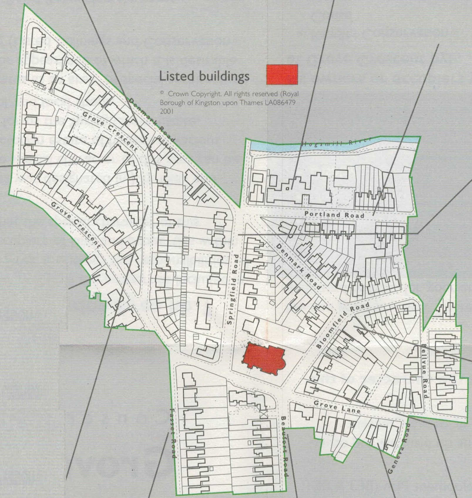
image source: Conservation Area leaflet, 2002.
Heritage Map - shows the updated version, complete with search facility
Designation summary
The special architectural and historic interest of this area can be summarised as: A planned mid-Victorian estate of houses of various sizes and styles, the core of which forms the Spring Grove Estate, including St John’s Church, a school, and local shops.
Historical Background
Evidence of Middle Stone Age and Bronze Age settlement in the immediate vicinity has been well recorded and it is likely that the existence of the Hogsmill River provided an attractive site for the manufacture of goods. In the Medieval period this conservation area was farmed on an open field system and was later enclosed between the mid-15th and mid-17th century.
The first part of this conservation area to be developed was Grove Crescent. Laid out around 1863 at the same time as the opening of Kingston Railway Station, it provided a new railway link to London and made commuting an attractive option. Kingston consequently became more built up and areas of housing started to radiate out from the new railway station. Evidence of the first housing, before 1865, was on the corner of Grove Crescent and Penrhyn Road (formerly Grove Road). The streetscape subsequently evolved in an easterly direction, in relation to the various interests of many builders.
In the 19th century, the Hogsmill River was deeper and faster flowing and a lack of bridges slowed the rate of building in Grove. It was not until the 1890’s that Springfield Road Bridge was built connecting the southern and northern halves of Grove. The idea of constructing the Blue Bridge, built by local landowner William Mercer, is central to an understanding of how the area started to identify itself at this time. The river crossing became a symbol of one man’s social and engineering vision, hoping to elevate the new estate to a status equal to Knights Park which was developed over the same period 1861-1871.
Key architectural features
The area contains a speculative mix of building styles, ranging from the larger houses and neat villas in Springfield Road and Denmark Road to the tighter knit cottages of Portland Road. There is also a strong Victorian Gothic style through the centre of the area, with smaller scale artisan dwellings to the east and grander Italianate buildings to the west.
Listed Buildings
Buildings of Townscape Merit
- The Spring Grove PH, 13 Bloomfield Road
- Former Vicarage to St John’s, 15 Springfield Road
- 7,9 Fassett Road
- 1, 3, 5, 7, 9 Grove Crescent
- 9, 19 Penrhyn Road
- St John's Primary School Portland Road
- Bollard Junction Alley and Denmark Road
- Chelsea W/Wks Marker - 14 Bellevue Road
- The Coach House 1 Beaufort Road
Adjacent Conservation Areas (CA) / Local Areas of Special Character (LASC)
- Grove Lane LASC
- Fairfield/Knights Park CA
Archaeological Priority Area
Yes
Article 4 Directions
None
More information
Grove Crescent Conservation Area Designation Report
Contacts
If you have any questions about this conservation area or would like to find out whether you need planning permission before carrying out works to your property, please contact the Duty Planning Officer on 020 8547 5002.
Documents available to download:
| Link | Description | Source | Published |
|---|---|---|---|
| CA 7 Planning Information | Conservation Area 7 - Planning Information (A5 size leaflet, fold out to A3) | RBK Director of Environmental Services | 2002 |