CA2: Old Malden
Designation date: March 1971
No of properties: 56
Area: 11.2 hectares
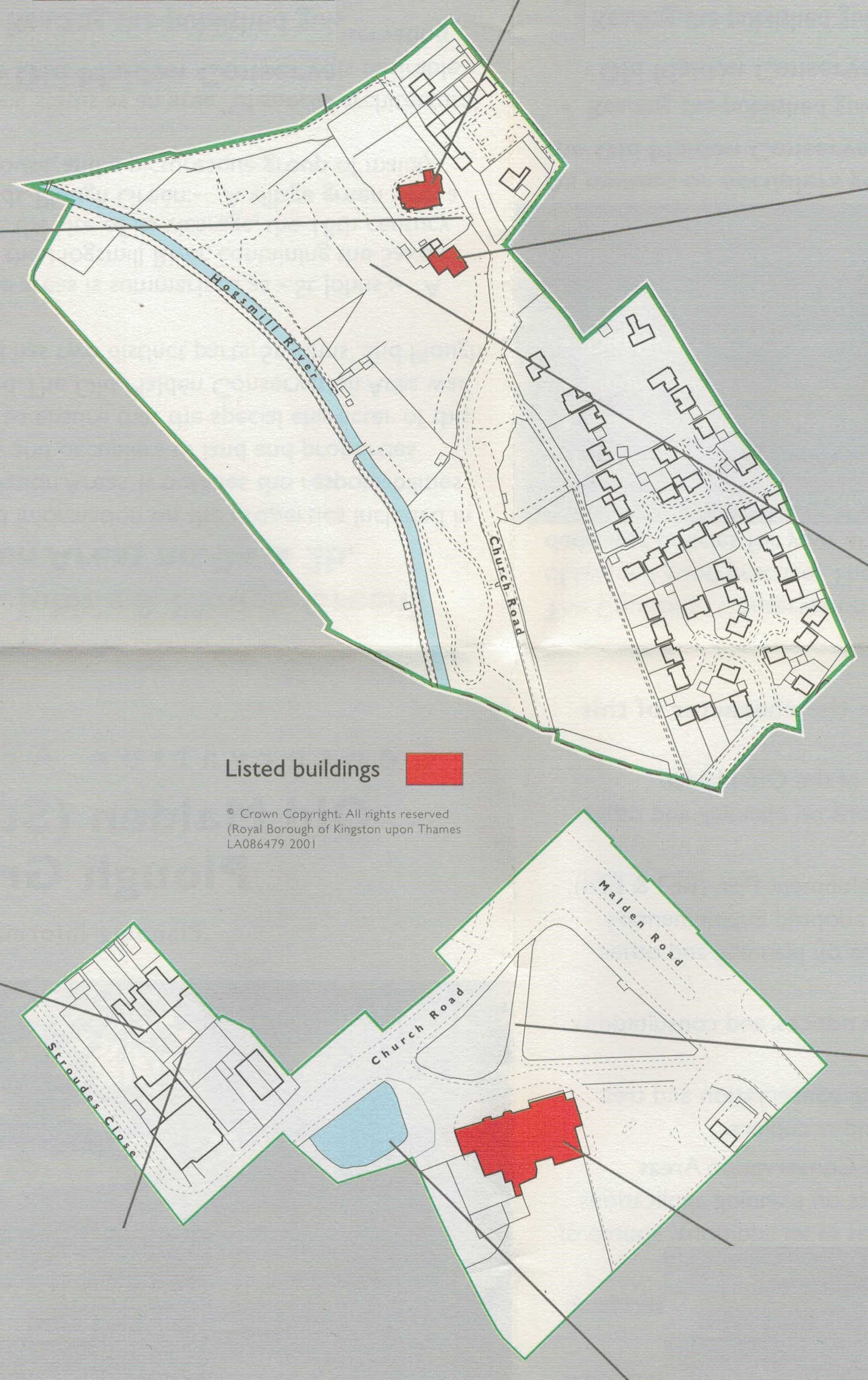
image source: Conservation Area leaflet, 2002.
Heritage Map - shows the updated version, complete with search facility
Designation summary
Made up of two distinct areas, the special architectural and historic interest of this area can be summarised as:
St John’s: (area A)
A medieval village centre next to the Hogsmill River, containing the Saxon Church of St. John the Baptist , the site of its vicarage, the Manor House and ancient fields.
Plough Green (area B)
A village green with a pond, a 15th century public house , and a picturesque group of mainly 19th century cottages.
Historic background summary
Malden takes its name from Maeldune which means 'cross upon the hill'. It is mentioned in the Domesday Book as having two manors, Meldone and Cisendone. The cross upon the hill is thought to have formed from the foundations of the Church of St John the Baptist, which still retains Saxon features and is Grade II listed. The area around the Church was also the original centre of the village and it is evident that there is a long history of settlement on the hill. Remains of an Iron age pottery have been found off Church Road, Roman remains in Manor Drive and some Norman and Medieval remains near the Vicarage.
At the end of the 16th Century the Church was almost in ruins but was repaired in 1610. The nave and the tower were rebuilt in brick but the chancel only needed repairing and the old flint and stone walls still remain. By the 16th Century the Manor House had also fallen into into disrepair and was almost completely rebuilt in the 17th Century and further alterations took place in the 18th and 19th Centuries.
At the east end of Church Road are Plough Green (Upper Green), the Plough Inn which is Grade II listed, the original village pond and a nearby group of old cottages of which numbers 16 to 28 are Buildings of Townscape Merit.
Listed Building (Area A)
- Manor House, Grade II listed
- Church of St John the Baptist, Grade II listed
- Old Malden War Memorial, Grade II listed
CA (Area B)
Buildings of Townscape Merit (Area A)
None
Buildings of Townscape Merit (Area B)
- 24, 26, 28, 30 Stroudes Close
- 22,20, 18, 16 Church Road
Adjacent Conservation Areas (CA) / Local Areas of Special Character (LASC)
None
Archaeological Priority Area
Yes
Article 4 Directions
None
Contacts
If you have any questions about this conservation area or would like to find out whether you need planning permission before carrying out works to your property, please contact the Duty Planning Officer on 020 8547 5002.
Documents available to download:
| Link | Description | Source | Published |
|---|---|---|---|
| CA 2 Planning Information | Conservation Area 2 - Planning Information (A5 size leaflet, fold out to A3) | RBK Director of Environmental Services | 2002 |